
Ruwenzori ziyareti
%{resort_name} seyahatinizi planlamanıza yardımcı olacak faydalı tatil yeri bilgileri
- Sezon başlangıcı—
- Sezon sonu—
- Konaklama—
- Restoranlar | Barlar— | —
- En Yakın Havaalanı —
- En Yakın Tren İstasyonu —
- Turizm Ofisi Web Sitesi
- Turizm Ofisi Telefonu—
Ruwenzori Özellikleri
Ruwenzori arazisi şunlar içerir:
- Halfpipe—
- Kayak parkları—
- X-Ülke—
- Kayak Kiralama—
What's it like at Ruwenzori?
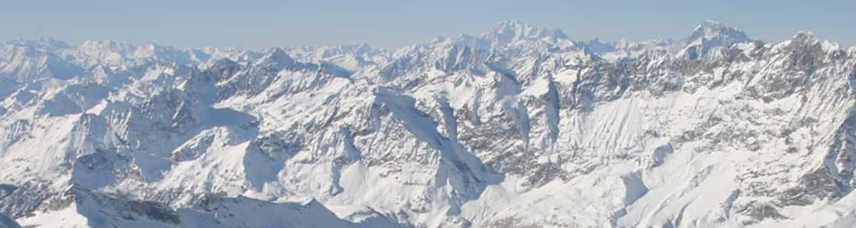
The Ruwenzori is a group of six high glaciated massifs, located in a small remote area between Lake Edward and Lake Albert on the border between Uganda and Zaire. This is part of the African Lake District, west of the Great Rift Valley. The massifs are all topped with several icy summits and are deeply divided by narrow 3,000-foot gorges. The complex is surrounded by a wide belt of boggy foothills, guarding the mountains with an approach through knee-deep mud and practically impassable vegetation. These conditions, coupled with frequent bad weather, saved Ruwenzori from exploration until well after the rest of East Africa had already been explored. In 150 AD, the distinguished geographer Claudius Ptolemy produced an early map of Africa on which a group of mountains just south of the equator were identified as Lunae Montes, or 'Mountains of the Moon'. They were shown to be an important water source, and were subsequently believed to be the source of the Nile. Although Kilimangaro and Kenya have been postulated as the mountains to which Ptolemy referred, it is widely held that the Ruwenzori Mountains are indeed the 'Mountains of the Moon'. The Zaire side is part of the Virunga National Park. Accommodations here are better than on the Uganda side, where mountain huts exist but are mostly run down and unsanitary.
Ruwenzori Arnsberg Konum Haritasını İnceleyin
Etkileşimli Ruwenzori parkur ve pist haritası. Bölge kırsalını dolaşmak için pist ve parkurların yanı sıra çevredeki arazi ve dağ yapısını görüntüleyin. Kayak merkezi işaretlerine tıklayarak yakındaki kayak merkezlerini bulun ve karşılaştırın.

Bir Ruwenzori ziyareti için en karlı ay hangisidir?

Ruwenzori Ziyaretçi Yorumları
Ruwenzori yakınındaki tatil yerleri
Ruwenzori yakınındaki kayak merkezlerini keşfedin. Oradaki kayak merkezi rehberlerini görmek için aşağıya tıklayın.
 Afriski Mountain ResortSon kar: 4.0 cm Thu 02 Jul
 Teleferikler: 4
 Kayak Pistleri: 23255 km uzakta
 TiffindellSon kar: 1.0 cm Thu 02 JulTeleferikler: 5Kayak Pistleri: 23465 km uzakta
 Mount HermonSon kar: 2.0 cm Mon 04 MayTeleferikler: 10Kayak Pistleri: —3709 km uzakta
 Zaarour ClubSon kar: 1.0 cm Tue 05 MayTeleferikler: 6Kayak Pistleri: —3776 km uzakta
- Mzaar Ski ResortSon kar: 3.0 cm Tue 05 MayTeleferikler: 14Kayak Pistleri: 423784 km uzakta
 Nearest